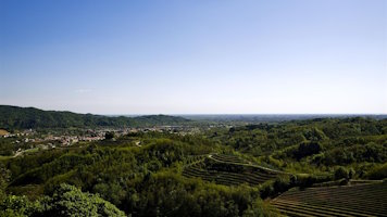
Vernasso - Submarine Landslide (Eocene)
The former marl quarry, abandoned by Italcementi in the late 1980s, covers an area of about 60 hectares on the eastern slope of Mount dei Bovi. This site comprises a paleolandslide dating back to the Eocene, approximately 50 million years ago.
Between the Mesozoic and Cenozoic eras, a major extinction event occurred, involving dinosaurs, ammonites, and many other life forms. Concurrently, the gradual convergence of tectonic plates was closing the vast Tethys Ocean. Mountain ranges such as the Eastern Alps and the Dinarides formed at these collision points, including at this location. As the mountains rose they were eroded by atmospheric agents, large landslides formed under the sea on the continental slope and the deposits filled a deep marine basin, the Julian (or Slovenian) Basin. These deposits are found in the Julian Prealps, from Tarcento to Cividale and beyond.
The oldest flysch, with large layers (beds or megabeds) up to tens of meters thick, is characterized by submarine landslide bodies. The two most extensive are those of Mount Joanaz (with a thickness of 130 meters) and Vernasso, the largest known fossil submarine landslide (olistostrome), which exceeds 250 meters in thickness. These layers characterize the landscape around Mount Bernadia, Mount Joanaz, and Mount Matajur.
Access to the quarry is prohibited, but the quarry faces are clearly visible from the road from Sanguarzo to Vernasso.

Archive of Regione Autonoma Friuli Venezia Giulia, Direzione centrale difesa dell'ambiente, energia e sviluppo sostenibile, Servizio geologico

Archive of Regione Autonoma Friuli Venezia Giulia, Direzione centrale difesa dell'ambiente, energia e sviluppo sostenibile, Servizio geologico

Archive of Regione Autonoma Friuli Venezia Giulia, Direzione centrale difesa dell'ambiente, energia e sviluppo sostenibile, Servizio geologico.

Archive of Regione Autonoma Friuli Venezia Giulia, Direzione centrale difesa dell'ambiente, energia e sviluppo sostenibile, Servizio geologico.