Many historians regard the Great War as an exceptional event, in that, for many aspects, it was different from previous conflicts, including the location of battlefields. Thanks to innovations in mountaineering and a (modest) modernization of military equipment, battles were fought on mountain tops for the first time. Military commands, in fact, considered such heights as highly strategic for their objectives: from atop, in fact, they could control valleys and enemy rear lines, organise quick attacks and position guns in privileged positions.
Any time a mountain was taken over, therefore, soldiers needed to build positions, trenches, barracks and observation points at high altitude, in order to exploit such favourable places. A case in point is Mt. Jôf di Somdogna, occupied by the Italians in the summer of 1915. Like Mt. Jôf di Miezegnot nearby, it stands at the end of the Dogna Valley in the midst of a beautiful natural scenario, in the heart of the Julian Alps and close to the northern side of Mt. Jôf di Montasio.
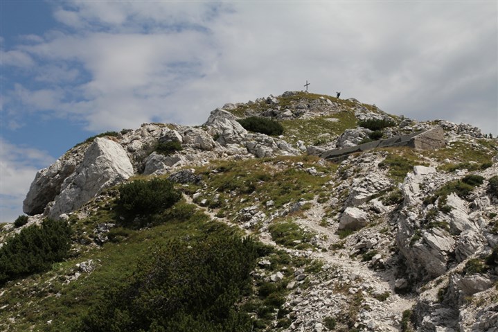
THE PEAK OF JOF DI SOMDOGNA. YOU CAN SEE THE REMAINS OF A MILITARY BUILDING LOCATED BELOW THE PEAK, ON THE SOUTHWEST SIDE
This is not a difficult route but it requires physical fitness. The departure point is located on the Somdogna Pass (1389 metres ASL), where the Dogna Valley Road ends. After a few metres on the path leading to the Grego Shelter, at a cement pool, follow the track on the right leading to Somdogna Lake. Continue along CAI trail No. 651, which takes you to the fork with CAI trail No. 610 in a few minutes, where you can see the remains of some trenches. Take the trail on the left and walk steeply along the northern ridge of the mountain up to the first remains of some military housing.
Here the trail is not steep, woods are replaced by pines and you can gradually take in the wonderful sights of Mt. Jôf di Montasio and the jagged summit of Mt. Jôf di Somdogna. At the fork at 1762m, make a left, where you can clearly see an entrenched line, then continue to the summit (marked by a summit cross), past the Kopfach Shelter on your right.
Continue your excursion on the opposite side, where CAI trail No. 652 starts descending into the core of the Italian fortifications. You can immediately see the ruins of a large military building and a fortified tunnel linked to the fortified trenches that used to connect the summit to various positions. Further on and off the track, you can admire the spectacular Tomb of the Magician.
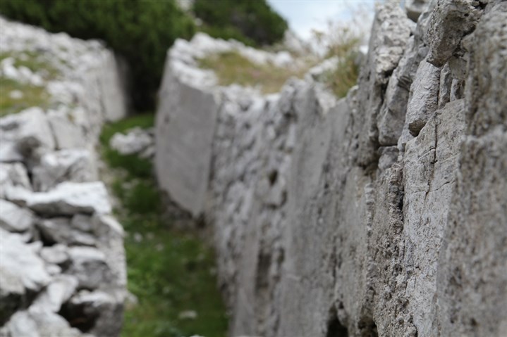
A CLOSE-UP OF A TRENCH UNDER THE PEAK OF THE JOF DI SOMDOGNA
Back to the military building, take the trail downhill on the southern side of the mount until you reach the Carnizza Valley. The descent is quite easy and offers an opportunity to see the Saisera Valley from atop as well as the vertical cliff of Mt. Jôf di Montasio. After about an hour, you reach the fork with CAI trail No. 611 and must turn left on the latter, walking carefully as this stretch is steeper. The trail first crosses the gravel riverbed of a stream and then takes you down into the woods, almost reaching the Saisera Valley, climbing then up again to a false slope and the Grego Shelter. On the left, CAI trail No. 651 takes you back to the departure point.


