Mt. Jôf di Miezegnot (2087 metres ASL) stands in the heart of the Julian Alps, surrounded by pristine and enchanting nature. If you are lucky to climb on a clear day, you will be rewarded with extraordinary views across the surrounding peaks (in particular, the northern slope of Mt. Jôf di Montasio).
Like Mt.Jof di Somdogna nearby, this height was occupied by the Italian troops during the Great War and its slopes host several military structures that can still be admired. These precious remains offer an opportunity to discover one of the most surprising aspects of the Great War: the life of soldiers at high altitude.
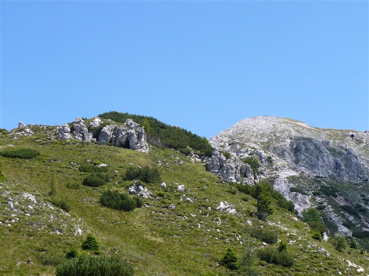
VIEW FROM THE PEAK OF MIEZEGNOT DURING THE CLIMB
The departure point of this route is the Somdogna Pass, where the Dogna Valley Road ends. Leave your car at the end of the road and walk to Casera Somdogna, then take CAI trail No. 609. The first stretch is in the woods but the mule track is well-signalled and climbs regularly uphill to a grassy plateau, where, on the right, you can admire some tombstones of a former war cemetery.
A few dozen metres away, you can see the ruins of an Alpine war village, an extraordinary cluster of buildings built at 1890m ASL. Continue uphill along CAI trail No. 609 to the gravel slope near the summit. Walk carefully along this stretch leading to the top. On the summit, you can see an iron cross and the remains of several structures, positions and, mostly, observation posts.
To go back, you can either walk the same trail or choose a way on the south-eastern ridge (following CAI trail No. 607). Along the latter, you can make a stop at Peceit ridge, where more Italian fortifications can be observed. Here, you must walk downhill on a mule track that used to connect these positions to the summit, until the point where the trail shifts to the northern side of the mountain. Instead of continuing along this track, on the right you can see a smooth trail leading to the valley where the war village is located and from where you must walk back on the same trail covered during the ascent.
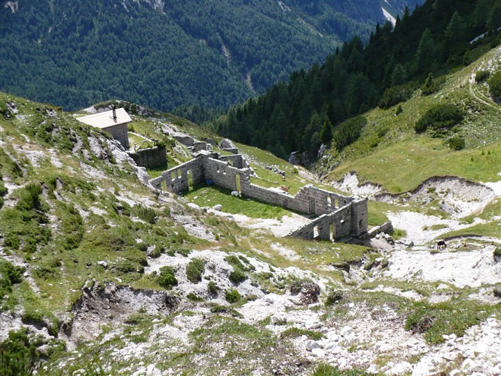
REMAINS OF A WAR VILLAGE SEEN FROM THE SECTION OF THE PATH THAT LEADS TO THE PEAK


