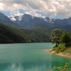
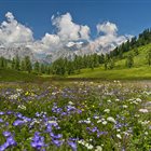
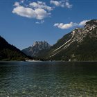
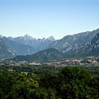
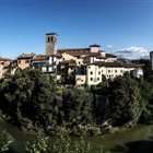
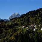
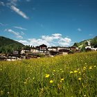
Thousand-year-old cultures, different linguistic strains, biodiversity and multifaceted territorial morphologies. Discover the peculiarities of the valleys, municipalities and areas of the mountains of Friuli Venezia Giulia
Discover the mountain Regions
Thousand-year-old cultures, different linguistic strains, biodiversity and multifaceted territorial morphologies. Discover the peculiarities of the valleys, municipalities and areas of the mountains of Friuli Venezia Giulia
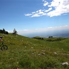
Summer or Winter, it doesn’t matter: skiers, pedestrians, hikers, bicycle lovers or who simply loves to enjoy a panoramic view, but without getting tired, will find open Ski lifts all over the year in the ski areas of FVG
Discover the Ski areas in Friuli Venezia Giulia
Summer or Winter, it doesn’t matter: skiers, pedestrians, hikers, bicycle lovers or who simply loves to enjoy a panoramic view, but without getting tired, will find open Ski lifts all over the year in the ski areas of FVG
Toprecommended route
Hiking trail
· Julian Alps
Open
Responsible for this content Friuli Venezia Giulia
The entrance to Vigant Abyss
Photo: Nicola Ceschia, Friuli Venezia Giulia
Selected alternatives for you
A simple itinerary suitable for everyone that allows you to discover the geological beauty of the area made up of caves, sinkholes and rocks carved by water
Open
moderate
Distance 5.3 km
Duration1:35 h
Ascent157 m
Descent157 m
Highest point665 m
Lowest point541 m
The Villanova Caves Geological Trail promises both a convenient family itinerary and a roundup of geological thrills for field enthusiasts. Standing in front of the monumental opening of the Vigant Abyss is a thrill that leaves no one indifferent.
The start is located at the Cave Terminal, where two information boards introduce the geological context of the area. In about 5 km of trail through the woods, one can admire dolines, karst sinkholes, contact caves and many other peculiarities.
The trail is ideally completed by a visit to the New Cave of Villanova, a tourist cave that can be visited by guided experience (info and departure always in front of Caves Terminal).
Main points of interest: old New Cave entrance in Zajama village, Doviza Cave, Rio Tanaloho, Vigant Abyss, old stone washhouse at Vigant, doline "Grotta dei Ragni", Feruglio Cave.
Author’s recommendation
Absolutely worth the small detour to Borgo Vigant to overlook the splendid balcony over Val Cornappo.
To complete the experience in the valley, a guided tour of the New Cave of Villanova is absolutely recommended. All information is available here
Author
Wild Routes
Responsible for this content
Friuli Venezia Giulia
Difficulty
T1moderate
Overall difficulty
moderate
Derived from the technical difficulty and the stamina requirements.
In case of accidents, the number to call is 112 NUE
Ticks are present throughout the Friuli Venezia-Giulia region, so it is advisable to inform yourself about prevention and protection techniques: Ticks information FVG region
The route is not recommended after and during adverse weather conditions and is not recommended on days following heavy rainfall.
Tips and suggestions
It is recommended to take home any waste and to preserve the places crossed as best as possible.
Please note that dogs must be kept on a leash.
It is recommended not to walk this route after periods of heavy rain as many sections are slippery.
Roadbook
Follow blue and white trail markers "GEOLOGICAL PATH"
Rest stop
Tip
Nearby
Top Partner
Waypoint
Start point
End point
Low point
High point
Forecast
Today {low} to {high} and {precipitation} of {precipitation_type}
show {x} more
Photo
Video
Public transport
By bus
There is only one local public transport line via bus in the Torre Valley. For schedules and stops, see the TPL FVG website.
By train
The nearest useful station is Tarcento, over 15km from Villanova delle Grotte.
Directions
Take SR646 from Tarcento, after about 4km turn right towards VILLANOVA DELLE GROTTE.
Parking
Ample parking and RV parking area behind Terminal Grotte restaurant. GPS point
Coordinates
DD
46.255824, 13.283044
DMS
46°15'21.0"N 13°16'59.0"E
UTM
33T 367666 5123904
w3w
///download.rigged.tenable
Get there by train, car, bike, or on foot!
Book recommendation by the author
Tobacco 026
Author’s map recommendations
"Alta Val Torre" Tourist Guide - Igor Cerno
Equipment
Equipment appropriate for outdoor activities is recommended:
Rain jacket;
Long pants;
T-Shirt;
Sweatshirt;
Hiking shoes or boots;
Hat;
Water and snacks;
First aid kit;
Tick spray
Localization
Parts of this content were machine translated using Italian as the source language
Similar routes nearby
Alta Val Torre loop - Lusevera
Ring of Gran Monte and Briniza
Pradielis - Micottis Loop
La Bernadia, a ridge suspended between history and karst
Zore Route
These suggestions were generated by our system
Status
Open
Difficulty
T1moderate
Overall difficulty
moderate
Derived from the technical difficulty and the stamina requirements.