loader
  • WHERE TO GO
    WHERE TO GO
    • Regions
      Discover the mountain Regions
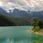
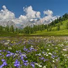
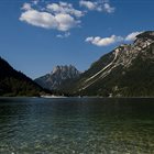
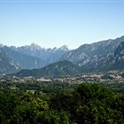
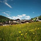
      Thousand-year-old cultures, different linguistic strains, biodiversity and multifaceted territorial morphologies. Discover the peculiarities of the valleys, municipalities and areas of the mountains of Friuli Venezia Giulia
      Discover the mountain Regions
      Thousand-year-old cultures, different linguistic strains, biodiversity and multifaceted territorial morphologies. Discover the peculiarities of the valleys, municipalities and areas of the mountains of Friuli Venezia Giulia
      All the mountain regions
    • Ski resort
      Discover the Ski areas in Friuli Venezia Giulia
      Summer or Winter, it doesn’t matter: skiers, pedestrians, hikers, bicycle lovers or who simply loves to enjoy a panoramic view, but without getting tired, will find open Ski lifts all over the year in the ski areas of FVG
      Discover the Ski areas in Friuli Venezia Giulia
      Summer or Winter, it doesn’t matter: skiers, pedestrians, hikers, bicycle lovers or who simply loves to enjoy a panoramic view, but without getting tired, will find open Ski lifts all over the year in the ski areas of FVG
      All ski resorts

From Truia to Stavoli di Orias and Sopravalle

Hiking trail recommended route Hiking trail  · Carnia
Logo Friuli Venezia Giulia
Responsible for this content
Friuli Venezia Giulia
  • Photo: Azzurra Forti @babytrekking, Friuli Venezia Giulia

Selected alternatives for you
    A walk through ancient pastures, forests, and scenic views in the heart of the Pesarina Valley
    easy
    Distance 1.9 km
    0:55 h
    265 m
    0 m
    1,148 m
    883 m
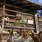
    The route begins in the hamlet of Truia, in Val Pesarina, which can be reached by car via a narrow, passable road. From the parking lot , follow the signs for the Stavoli di Orias along a paved road that climbs steadily and leads to the destination in about twenty minutes. The village, situated in a panoramic location, consists of twelve “stavoli”—traditional rural buildings typical of Carnia that were once used as temporary shelters during the summer grazing season. Today, many of these buildings have been skillfully restored, preserving the charm of their traditional architecture. At the end of the village, take the forest road on the left—which is unmarked—that winds through the woods and leads to the Stavoli di Sopravalle in about thirty more minutes . This small rural settlement consists of four buildings—two restored and two still in their original state—nestled in the tranquility of nature.

    Author’s recommendation

    There is a picnic area at Stavoli di Sopravalle
    Profile picture of PromoTurismoFVG Montagna
    Author
    PromoTurismoFVG Montagna 
    Logo Friuli Venezia Giulia
    Responsible for this content
    Friuli Venezia Giulia 
    Difficulty
    T1 easy
    Overall difficulty
    easy

    Derived from the technical difficulty and the stamina requirements.

    Experience
    Landscape
    Highest point
    1,148 m
    Lowest point
    883 m
    Best time of year
    Jan
    Feb
    Mar
    Apr
    May
    Jun
    Jul
    Aug
    Sep
    Oct
    Nov
    Dec

    Track types

    Asphalt 44.42%Forested/wild trail 38.24%Unknown 17.33%
    Asphalt
    858 m
    Forested/wild trail
    739 m
    Unknown
    335 m
    Show elevation profile

    Safety information

    There is a water fountain at Stavoli di Orias.

    Caution: The road is rather narrow

    .

    Tips and suggestions

    Option to park your car in the village of Truia (very few parking spaces)
    Rest stop
    Tip
    Nearby
    Top Partner
    Waypoint
    Start point
    End point
    Low point
    High point
    Forecast
    Today {low} to {high} and {precipitation} of {precipitation_type}
    show {x} more
    Photo
    Video
    Stables of Orias

    Coordinates

    DD
    46.524081, 12.790920
    DMS
    46°31'26.7"N 12°47'27.3"E
    UTM
    33T 330570 5154650
    w3w 
    ///catcher.fatherhood.bedbug
    Get there by train, car, bike, or on foot!

    Equipment

    standard mountain clothing

    Localization

    Parts of this content were machine translated using Italian as the source language

    Similar routes nearby

    • Monte Talm from Piani di Vas
    • Malga Novarzutta - 4B
    • Malga Losa - 4A
    • Casera Vas - Casera Monte Buoi Ring
    • Veltrpoch - 4D
     These suggestions were generated by our system
    Difficulty
    T1 easy
    Overall difficulty
    easy

    Derived from the technical difficulty and the stamina requirements.

    Distance
    1.9 km
    Duration
    0:55 h
    Ascent
    265 m
    Highest point
    1,148 m
    Lowest point
    883 m
    Linear route Scenic Family-friendly Flora Fauna Dog-friendly

    Statistics

    • Content
    • Show images Hide images
    Features
    2D 3D
    Maps and trails
    Nothing selected - click and drag in the elevation profile to zoom
    Distance
    Duration
    Ascent
    Descent
    Elevation profile