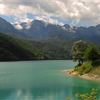
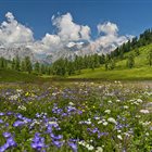
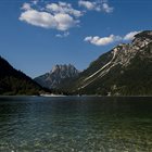
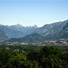
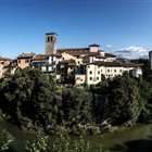
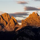
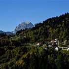
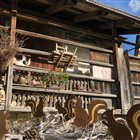
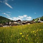
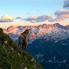
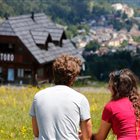
Thousand-year-old cultures, different linguistic strains, biodiversity and multifaceted territorial morphologies. Discover the peculiarities of the valleys, municipalities and areas of the mountains of Friuli Venezia Giulia
Discover the mountain Regions
Thousand-year-old cultures, different linguistic strains, biodiversity and multifaceted territorial morphologies. Discover the peculiarities of the valleys, municipalities and areas of the mountains of Friuli Venezia Giulia
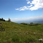
Summer or Winter, it doesn’t matter: skiers, pedestrians, hikers, bicycle lovers or who simply loves to enjoy a panoramic view, but without getting tired, will find open Ski lifts all over the year in the ski areas of FVG
Discover the Ski areas in Friuli Venezia Giulia
Summer or Winter, it doesn’t matter: skiers, pedestrians, hikers, bicycle lovers or who simply loves to enjoy a panoramic view, but without getting tired, will find open Ski lifts all over the year in the ski areas of FVG
Toprecommended route
Hiking trail
· Friuli Venezia Giulia
Responsible for this content Friuli Venezia Giulia
Photo: Azzurra Forti @babytrekking FVG, Azzurra Forti @babytrekking FVG
Selected alternatives for you
A pleasant hike through pastures, forests, and scenic views to the panoramic Malga Meleit, in the heart of the Zoncolan
easy
Distance 5.1 km
Duration1:30 h
Ascent116 m
Descent309 m
Highest point1,737 m
Lowest point1,543 m
Start from the Sella Zoncolan parking lot and follow the paved road downhill, which leads to the Tamai Mountain Hut in about ten minutes. From here, continue along the dirt road on the left, which continues downhill through wide pastures, offering splendid views of the village of Zoncolan and the surrounding mountains. The trail descends to Malga Tamai—a facility not open to the public—and then continues with a short climb. Along this stretch, the view opens up onto the green slopes of Monte Tamai and the peaks of Carnia, offering truly captivating vistas. In the distance, you can see Malga Agareit, though you won’t reach it: at the marked fork, turn left. After about twenty minutes of walking through the woods, the vegetation gradually gives way to a wide meadow plateau from which the distinctive Malga Meleit comes into view a little further down. A few downhill switchbacks lead to the destination, a mountain hut open during the summer season where you can stop to enjoy traditional local dishes. The panoramic setting, surrounded by pastures and mountains, makes this hike particularly enjoyable for those who wish to spend a day immersed in the natural beauty of the Zoncolan.
Author’s recommendation
Suitable for hiking strollers; keep in mind the uphill return trip. Terrain: unpaved forest road—some sections lined with trees.
Malga Meleit is open during the summer from June to September; we recommend always checking to see if it’s open. Malga Meleit
Author
PromoTurismoFVG Montagna
Responsible for this content
Friuli Venezia Giulia
Difficulty
T1easy
Overall difficulty
easy
Derived from the technical difficulty and the stamina requirements.
Experience
Landscape
Highest point
1,737 m
Lowest point
1,543 m
Best time of year
Jan
Feb
Mar
Apr
May
Jun
Jul
Aug
Sep
Oct
Nov
Dec
Track types
Asphalt 6.16%Dirt road 87.09%Path 6.73%
Asphalt
316 m
Dirt road
4.5 km
Path
345 m
Show elevation profile
Safety information
A route with no water fountains and mostly exposed to the sun
Rest stop
Tip
Nearby
Top Partner
Waypoint
Start point
End point
Low point
High point
Forecast
Today {low} to {high} and {precipitation} of {precipitation_type}
show {x} more
Photo
Video
Monte Zoncolan
Directions
Start at Sella Zoncolan – finish at Malga Meleit. There is a small, free parking lot at the starting point.
Parking
Zoncolan Pass
Coordinates
DD
46.501750, 12.927340
DMS
46°30'06.3"N 12°55'38.4"E
UTM
33T 340967 5151884
w3w
///sketching.funk.backgammon
Get there by train, car, bike, or on foot!
Equipment
Mountain Clothing
Localization
Parts of this content were machine translated from Italian.
Similar routes nearby
Mount Tamai, Arvenis, and the mountain huts of Zoncolan
The Delightful Bosco Bandito by Mieli in Gracco
10 thousand steps of health FVG - OVARO
10 thousand steps of health FVG - CERCIVENTO
From Museis to the Moscarda Tower: A Journey Through Scenery and History
Campanili del Lander from Piano d'Arta
Loop of the Tarond and Crasulina lakes
These suggestions were generated by our system
Difficulty
T1easy
Overall difficulty
easy
Derived from the technical difficulty and the stamina requirements.
Distance
5.1 km
Duration
1:30 h
Ascent
116 m
Descent
309 m
Highest point
1,737 m
Lowest point
1,543 m
Linear routeScenicFamily-friendlyFloraInsider tipDog-friendlySuitable for strollers
Statistics
Content
Show imagesHide images
Features
2D
3D
Maps and trails
Nothing selected - click and drag in the elevation profile to zoom