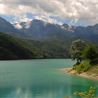
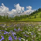
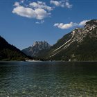
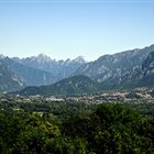
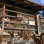
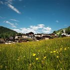
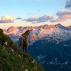
Thousand-year-old cultures, different linguistic strains, biodiversity and multifaceted territorial morphologies. Discover the peculiarities of the valleys, municipalities and areas of the mountains of Friuli Venezia Giulia
Discover the mountain Regions
Thousand-year-old cultures, different linguistic strains, biodiversity and multifaceted territorial morphologies. Discover the peculiarities of the valleys, municipalities and areas of the mountains of Friuli Venezia Giulia
Summer or Winter, it doesn’t matter: skiers, pedestrians, hikers, bicycle lovers or who simply loves to enjoy a panoramic view, but without getting tired, will find open Ski lifts all over the year in the ski areas of FVG
Discover the Ski areas in Friuli Venezia Giulia
Summer or Winter, it doesn’t matter: skiers, pedestrians, hikers, bicycle lovers or who simply loves to enjoy a panoramic view, but without getting tired, will find open Ski lifts all over the year in the ski areas of FVG
Responsible for this content Friuli Venezia Giulia
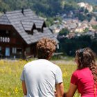
Photo: Azzurra Forto @babytrekking, Friuli Venezia Giulia
Selected alternatives for you
An easy walk through the woods, along the But Stream, and past the historic Moscarda Tower, offering panoramic views and glimpses into the past.
easy
Distance 2.7 km
Duration1:05 h
Ascent119 m
Descent106 m
Highest point685 m
Lowest point617 m
The route startsat the Bosco di Museis farmhouse, in the hamlet of the same name in Paluzza, and follows the bike and pedestrian path that winds through the woods on a gentle incline. Along the way, you’ll pass several old farmhouses—some now abandoned and others recently restored— bearing witness to the valley’s rural heritage. The road then continues on a gentle descent until it exits the woods, where a series of hairpin turns surrounded by greenery lead to the picturesque bridge over the But stream, offering a stunning view. After carefully crossing the bridge and the provincial road, follow the signs for Torre Moscarda. Just before reaching the tower, in the woods on the right, you can see several land art installations. The tower, built in the 13th century as a defensive and customs outpost along the ancient Via Julia Augusta, overlooks the valley and today houses an exhibition space dedicated to the local area. At its base, you’ll also find bunkers and military structures belonging tothe Torre Moscarda Barrier, built in the late 1930s and later repurposed; these can be visited during special open house events.
Author’s recommendation
The hike starts at the Bosco di Museis farmhouse; there are no places to eat along the route.
Picnic areas are located just below the Moscarda Tower
.
Suitable for hiking strollers.
Author
PromoTurismoFVG Montagna
Responsible for this content
Friuli Venezia Giulia
Difficulty
T1easy
Overall difficulty
easy
Derived from the technical difficulty and the stamina requirements.
The hike starts at the Bosco di Museis Agritourism, where you can park (very limited spaces). Alternatively, you can leave your car a little earlier, at a clearing just before the cobblestone climb leading to the agriturismo (https://maps.app.goo.gl/XxEXez8Gzv6SPPCv6)
Rest stop
Tip
Nearby
Top Partner
Waypoint
Start point
End point
Low point
High point
Forecast
Today {low} to {high} and {precipitation} of {precipitation_type}
show {x} more
Photo
Video
Coordinates
DD
46.532570, 13.005305
DMS
46°31'57.3"N 13°00'19.1"E
UTM
33T 347036 5155155
w3w
///basics.asleep.scrag
Get there by train, car, bike, or on foot!
Equipment
Normale abbigliamento da trekking
Localization
Parts of this content were machine translated from Italian.
Similar routes nearby
10 thousand steps of health FVG - CERCIVENTO
Campanili del Lander from Piano d'Arta
Lake Dimon and loop of the Paularo, Dimon, and Neddis mountains
Lake Avostanis from Malga Promosio
Carnic Crossing - Stage 7 of 11
Pal Piccolo, trails of soldiers and Carnic porters
From Sella Zoncolan to Malga Meleit
These suggestions were generated by our system
Difficulty
T1easy
Overall difficulty
easy
Derived from the technical difficulty and the stamina requirements.
Distance
2.7 km
Duration
1:05 h
Ascent
119 m
Descent
106 m
Highest point
685 m
Lowest point
617 m
Linear routeFamily-friendlyDog-friendlySuitable for strollers'Healthy climate'
Statistics
Content
Show imagesHide images
Features
2D
3D
Maps and trails
Nothing selected - click and drag in the elevation profile to zoom