The peaks surrounding Cason di Lanza Pass (1552 metres ASL) reward mountaineers and history lovers with unique views. Extensive pine woods alternate with wide green meadows, while majestic cliffs conceal the remains of the Great Wall above.
A section of the former Italian-Austrian border used to stretch along these peaks and numerous trenches and caves were dug to prevent possible breakthrough of the Austro-Hungarian troops.
Strategically, both Cason di Lanza and, at a lower altitude, the Incarojo Valley, were potential access routes to Carnia and the Friulian plain, bypassing Pass of Monte Croce Carnico (to the west) and Canale Valley (to the east).
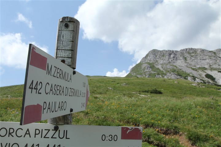
THE CROSSROADS ALONG THE PATH CAI 442A THAT LEADS TO 442. FROM HERE THE CLIMB TO THE PEAK OF THE ZERMULA AND THE FIRST TESTIMONIES OF THE GREAT WAR CAN BE SEEN
The itinerary of Mt. Zermula is undoubtedly one of the most scenic routes in the area. The departure point is found behind the barrack abandoned by the Tax and Revenue Police (on the pass). Here is where CAI trail No. 442a starts, easily leading to Forca di Lanza (1831 m), a large meadow with great views across the Incarojo Valley below. Past the first fork, walk straight and you will meet another fork, where you must turn right and take CAI trail No. 442. This is a slightly steeper track and includes the first remains of trenches. The south-eastern side of the Zermula massif stands right in front of you.
After a few dozen metres, CAI trail No. 442 leads to a fork. The normal trail continues on the left, while on the right the track heads straight to the first rocks of the mountain. The latter is not signalled as a CAI trail, but we recommend it as it takes you straight to the "Walk of trenches" under the crest of the Zermula massif. Several remains of the Great War can be seen along this route. The first stop is an easy reach, a large inscription dating back to 1916 and the entrance of a tunnel crossing the crest. After a few hundred metres, another tunnel leads to a triple observation post, from where you can see the mountains to the north and the Pass of Cason di Lanza below. Once outside, the trail passes through the ruins of some defensive walls and fortifications, while from this point you can clearly see the trenches met before on the Forca di Lanza. Past the beginning of the via ferrata, you reach the eastern summit (2129 metres ASL) of Mt. Zermula and then, climbing up a green slope, the actual mountain top (2143 metres ASL) with the summit cross. The mountain top offers wonderful 360-degree views of the surrounding peaks.
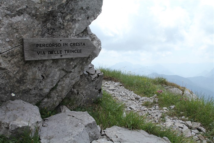
THE SIGN ON THE CREST THAT INDICATES THE START OF THE ITINERARY IN WHICH MOST OF THE TESTIMONIES OF THE GREAT WAR CAN BE FOUND
Now you can start descending: walk back along the same green slope and make a right before taking the "Walk of trenches" again, rapidly reaching CAI trail No. 442. Although there are some exposed sections here, this trail is not particularly difficult and leads to the discovery of an altarpiece dedicated to the Susa Battalion and then continues to the point where you met the fork during the ascent. Here, walk on CAI trail No. 442a, the same trail used on the way up; it is less than an hour back to Cason di Lanza Pass.


